Key Takeaways
- A drone mapping app tells the drone where to fly, takes a lot of photos of the ground and joins them into one big map you can measure.
- You don’t have to build every part. Most teams build the pilot’s app and the client’s screen, and use an existing tool to join the photos.
- From December 2025, new drone models made outside the US can’t get approval for sale in the US. So an app that works with only one drone brand is a risk now.
- A first version takes around four to six months . The cost mostly depends on how many drone brands you want to support.
- Your app should help pilots follow drone rules in Canada and the US, and it must keep the photos and people’s details safe.
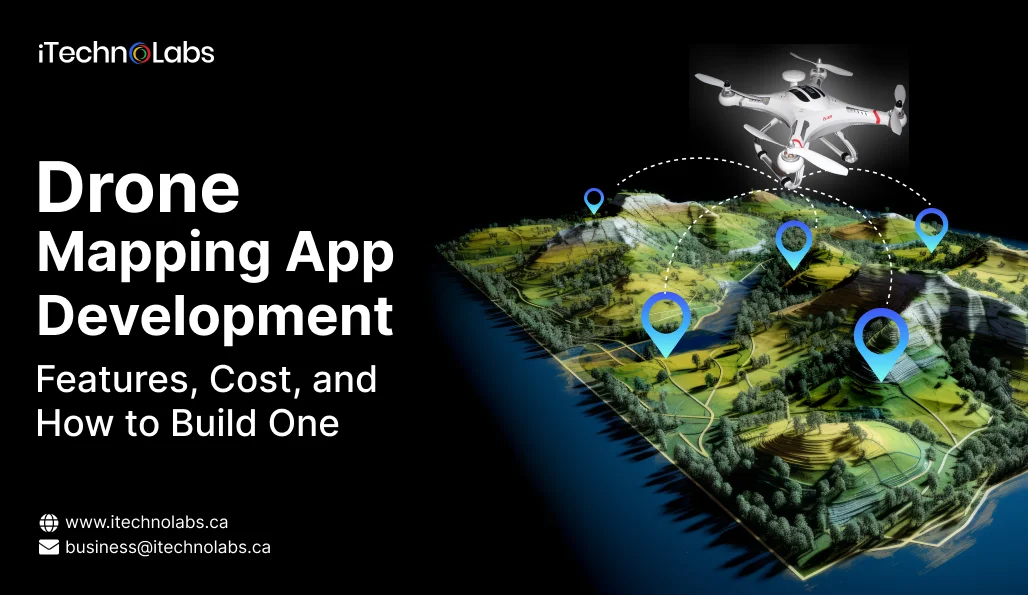
Drone mapping app development means building an app that plans a drone’s flight, takes overlapping photos of the ground and joins them into one accurate map or 3D model. A basic version lets the pilot plan the flight, take the photos, make the map and share it. Most first versions take four to six months.
A lot of people now fly drones for work. The FAA’s own numbers show 453,635 commercial drones registered in the US as of November 2025, and 481,760 certified drone pilots. Most of these pilots don’t want a folder of photos at the end of a job. They want a map they can hand over to a client. But the tools they use keep changing. One well-known flight planning app was shut down in 2025, and a new US rule has changed which drones are safe to build around. If you’re a founder planning a mapping product, these two things will shape most of your early choices.
Table of Contents
- What Is a Drone Mapping App and How Does It Work?
- Should You Build Custom Drone Mapping Software or Use a Ready-Made Tool?
- What Features Should a Drone Mapping App Have?
- What Does a Drone Mapping App Need Behind the Scenes?
- How Does the 2025 US Drone Rule Affect Your App?
- What Rules Does a Drone Mapping App Need to Follow?
- How Do You Build a Drone Mapping App, Step by Step?
- How Much Does Drone Mapping App Development Cost?
- What Mistakes Hurt Drone Mapping App Projects?
- Why Choose iTechnolabs for Drone Mapping App Development?
- Conclusion
- Frequently Asked Questions
What Is a Drone Mapping App and How Does It Work?
A drone mapping app takes one drone flight and gives you one map at the end. It has three parts, which are the pilot’s app, the tool that joins the photos, and the screen where your client sees the result.
Let us take a simple job. A pilot reaches a building site and opens the app on a tablet. They draw a line around the site on the map. The app then works out how high the drone should fly and which route it should take. After that, the drone flies on its own, going up and down the site in rows, a bit like someone mowing a lawn.
It keeps taking photos as it flies. Every photo overlaps the next one by a good amount, and this overlap is what helps the software match them later.
Once the drone lands, the photos are uploaded online. The software looks for the same spots in hundreds of photos and stitches them into one large picture, taken from straight above. It can also make a 3D model and tell you the height of the ground at any point. Your client opens their screen, checks how much sand is lying in a pile, and compares this week’s site with last week’s.
| Part | What It Does | Who Uses It |
| Pilot’s app | Plans the flight, flies the drone, checks the photos | The pilot, on a tablet |
| Photo-joining tool | Joins hundreds of photos into one map and a 3D model | Runs online in the background |
| Client screen | Shows the map, lets people measure, share and download | Site manager, farmer, engineer |
Should You Build Custom Drone Mapping Software or Use a Ready-Made Tool?
If you only need maps for your own work, a ready-made tool is fine. Build your own when the map itself is your product, or when your clients need something the ready-made tools can’t give.
Some ready-made names you’ll come across are DroneDeploy, Pix4D and DJI Terra. There’s also OpenDroneMap, which anyone can use for free. With any of these you can start mapping in a few days. You pay a monthly fee and you’re running. But you also have to go along with whatever the company decides next.
Pix4D shows how this can hurt. It took its PIX4Dcapture Pro app off the app stores and retired it on July 31, 2025. Support stopped from August 1. Pilots who planned all their flights in that app had to look for another one in a hurry, through no fault of their own.
Building your own makes more sense when:
- you want to sell maps to clients under your own brand name
- your clients fly more than one drone brand
- you use a special camera that ready-made tools don’t handle well
- the maps need to go straight into software your client already uses
- the photos have to be stored in one particular country
| Point | Ready-Made Tool | Your Own App |
| Time to start | A few days | Four to six months |
| Money upfront | Small, monthly fee | More, for the build |
| Whose name clients see | The tool company’s | Yours |
| Which drones work | Their choice | Your choice |
| Where photos are kept | Their servers | Where you decide |
| If the company changes plans | You have to adjust | You stay in control |
Your own app does cost more and takes longer at the start. It’s worth it only when mapping is the main business, not something you do on the side.
What Features Should a Drone Mapping App Have?
Begin with what a pilot needs to finish one job properly. The fancy features can come later, once real users tell you what they want.
In the pilot’s app, the must-haves are fairly clear. The pilot should be able to draw the area on a map and get the flight route made for them. They should pick the flying height and see how clear the final map will look before take-off. The app should also tell them how many batteries the job needs.
Two more features save a lot of trouble later. One is working without the internet, because many sites like farms and quarries have poor signal. The other is a warning during the flight if photos come out blurry or dark. That way the pilot fixes it on the spot, not after driving back to the office.
After the flight, the app should join the photos into one map, make a 3D model and show the height of the ground.
On the client’s screen, people want to measure length, area and how much material is in a pile. They also like to put two dates side by side and see what changed. Sharing a link with their own client and downloading files for their engineers come next. Different login levels matter too, so that a site visitor can look at a map but can’t delete it.
Things like AI that spots cracks or counts plants, crop health maps and automatic PDF reports can wait for the second version. If you do plan AI features, our AI development company page explains how we plan them with clients.
| Feature | First Version | Later |
| Plan the flight on a map | Yes | |
| Works without internet | Yes | |
| Photo check during flight | Yes | |
| Map, 3D model and ground height | Yes | |
| Measure length, area and piles | Yes | |
| Share link and download files | Yes | |
| Compare two dates | Basic | Detailed reports |
| AI to spot cracks or count plants | Yes | |
| Crop health maps | Yes | |
| Links to client’s other software | Yes |
What Does a Drone Mapping App Need Behind the Scenes?
There are a few main pieces behind every drone mapping app. You don’t need to know how they work inside. You only need to know what each choice will cost you in time and money, and how easy it is to change later.
The first piece is the link between your app and the drone. Every drone company gives app makers a kit so their app can control the drone. DJI has its own kit. Many other drone brands follow one common, open set of rules, so one link can work with dozens of models. Whichever you pick here decides which drones your clients can use.
Next is the pilot’s app itself. Pilots mostly carry tablets in the field. The drone kits usually work best when you make one app for Android and a separate one for iPhone. A single app for both is possible, but it needs extra work to talk to the drone, so plan for that early.
Then comes the tool that joins the photos. You can pay a licence fee for a paid one, or use OpenDroneMap, which is free. Free saves money, but then your own team has to set it up and keep it running.
Storage is the fourth piece. One big site can give you thousands of photos in a single flight, and joining them requires very powerful computers. Most teams rent these computers by the hour instead of buying them.
The last piece is the map viewer. This is what your client opens in their web browser to zoom in, measure and mark things, without installing anything.
Our custom software development team usually settles these five choices with the client in the first two weeks, since everything else depends on them.
How Does the 2025 US Drone Rule Affect Your App?
New drone models made outside the US can’t get approval for sale there any more. So if your app works with only one such brand, your US clients may find it hard to buy drones for it.
On December 22, 2025, the US Federal Communications Commission (FCC) put foreign-made drones and their main parts on its Covered List. Any new model on this list can’t get FCC approval, and without approval it can’t be brought into the US for sale. Drones that were approved before that date can still be sold and flown. The same update also named DJI and Autel Robotics under US defence law.
What does this mean for your app? For now, your existing users are okay. Their drones still work. The problem is with new models. New drones from the affected brands won’t reach US shops the normal way. If your app works only with them, your US growth depends on a legal fight you have no say in.
The answer lies in how you build the app. Keep the drone link as a separate piece that can be swapped out, instead of mixing it into every part of the app. Support the common open set of rules from the first day, along with any one brand you need. And test your flights on a computer copy of the drone, so you don’t have to buy every model.
This rule is only for the US. It doesn’t change which drones people in Canada can buy. An app that works with many brands lets you sell in both countries with one product.
What Rules Does a Drone Mapping App Need to Follow?
Flying rules are the pilot’s job, but your app can make that job easier. The photos and personal details your app keeps are your responsibility.
In Canada, Transport Canada says drones that weigh between 250 g and 25 kg must be registered, and the pilot needs a drone pilot certificate. There are three main types of flying, called basic, advanced and Level 1 complex. Anything outside these usually needs special permission. Your app can keep a copy of each pilot’s certificate and drone registration. It can also show no-fly areas on the map and keep a record of every flight.
In the US, people who fly drones for work follow the FAA’s Part 107 rules and need a remote pilot certificate. Here too, the app should keep flight records ready in case anyone asks for them.
Then there’s privacy. Drone photos pick up people, cars and backyards, whether you want them or not. In Canada, the Personal Information Protection and Electronic Documents Act (PIPEDA) covers how private businesses collect and use people’s personal details. Your app can help by blurring faces and number plates. It should let clients delete their data when they ask, and keep it stored in their own country if they need that.
Security matters as much. Every photo and flight record should sit behind proper logins, with different levels of access. The data should also be locked in a way that outsiders can’t read it, both while it’s being sent and while it’s stored. iTechnolabs works under an ISO 27001:2013 certified process for keeping information safe, which covers this kind of handling.
How Do You Build a Drone Mapping App, Step by Step?
It’s safer to build in small stages. At the end of each stage, you have something you can test in the field.
| Stage | What Happens | Time |
| 1. Planning | Decide users, drone brands, must-have features and where data is kept | 2 to 3 weeks |
| 2. Design | Make screens that pilots can tap through before building starts | 3 to 4 weeks |
| 3. First test flight | Fly one real job from your own app | 3 to 4 weeks |
| 4. Pilot’s app | Flight planning, offline maps, photo checks | 6 to 8 weeks |
| 5. Photo joining and client screen | Making the map, measuring, sharing, logins | 6 to 8 weeks |
| 6. Accuracy check | Fly over measured points and compare | 2 to 3 weeks |
| 7. Launch | Send to app stores, fix their comments, go live | 2 to 3 weeks |
Stages 4 and 5 happen at the same time. That’s why the total comes to about four to six months, not the sum of every row.
Stage 3 is worth giving extra time. Getting one real flight working from your app early tells you more than months of planning on paper. If the drone link is going to give you trouble, you’d rather know in week eight than in week twenty.
A lot of founders want to skip stage 6, and that’s a mistake. Before the flight, a surveyor places a few markers on the ground and notes their exact position. After the map is made, you check if your map shows those markers in the right place. If it doesn’t, builders and surveyors won’t trust your measurements. Our mvp development service follows these same stages for every new product we build.
How Much Does Drone Mapping App Development Cost?
Three things decide most of the price. How many drone brands you support, whether you set up your own photo-joining tool, and how many extra features you add. The numbers below are rough estimates from our general project work, not a quote.
| Level | What You Get | Cost in USD | Time |
| Starter | One drone brand, pilot’s app, paid photo-joining tool, simple client screen | 40,000 to 70,000 | 3 to 4 months |
| Growth | Two or more brands, your own photo-joining setup, measuring, sharing, login levels | 80,000 to 150,000 | 5 to 7 months |
| Advanced | AI features, crop health maps, links to client software, many companies on one platform | 150,000 to 300,000+ | 8 to 12 months |
Some costs don’t show up in the first quote, so ask about them early. Rented computer time for joining photos is one, and big sites cost more per job. Storage is another, because photos keep adding up week after week. Paid photo-joining tools often charge per user or per job. You’ll also need at least one drone of every brand you support, plus spare batteries. Keep around 15 to 20% of the build cost aside every year for updates and fixes . And drone apps can take longer to get approved on app stores, so leave a few extra weeks before your launch date.
For a quick rough figure on your own idea, you can try our app cost calculator.
What Mistakes Hurt Drone Mapping App Projects?
Most of these projects don’t go wrong because of bad coding. They go wrong because of early choices that are costly to change later.
The most common one is building for just one drone brand. It feels quicker at the start. Then a rule changes, or a big client wants a different drone, and you end up rebuilding the main part of your app.
Forgetting about the poor internet is another. Quarries, farms and highway sites often have weak signals or none at all. If the app can’t plan and fly without the internet, pilots will quietly stop using it.
Some teams skip the accuracy check to launch faster. A map that looks nice but measures wrong is worse than having no map, because builders and surveyors will compare your numbers with their own.
Storage also catches people off guard. Photos come in every week, and if there’s no plan to move old jobs to cheaper storage, the monthly bill keeps going up.
And many teams try to build every feature in the first version. It’s better to launch with what one pilot needs to finish one job, then let real users tell you what to add.
Why Choose iTechnolabs for Drone Mapping App Development?
You need one team that can build the pilot’s app, the photo-joining setup and the client screen together. You also need a way of working that keeps your data safe and your launch date on track.
iTechnolabs is a software and AI development company for founders and growing businesses that need custom apps built, updated or grown. Best for: first versions of new products, field apps, AI features and data dashboards.
We’re ISO 27001:2013 certified for information security and ISO 9001:2015 certified for quality management. We’ve delivered 500+ apps, used by 50,000+ people, and we have 300+ developers working across mobile, web, AI and cloud projects. Our offices are in Markham, Calgary and Ottawa in Canada, and in Sheridan, Wyoming in the US, so we know both the markets this guide talks about.
In the planning stage, we’ll tell you clearly which parts we’d build, which ones we’d buy a licence for, and where an outside drone expert might help. Once your first version is live, you can also add dedicated developers from iTechnolabs’ development team.
Conclusion
There are plenty of ready-made drone mapping tools around, but there’s still space for products made for one kind of client. A mining company might need stockpile numbers every week. A group of farmers might want crop maps inside software they already use. A survey firm might want its own name on every report. Each of these is a real business, and a monthly subscription to someone else’s tool won’t fully serve any of them.
Building such an app isn’t a mystery any more. The pilot’s app, the photo-joining tool and the client screen are all well-tested ideas. What makes one product better than another is a small set of early choices. Which drones will you support? Will the app work without the internet? How will you check accuracy before launch, and where will your clients’ photos be stored?
The 2025 US drone rule has made the first of these choices more urgent. Building an app that works with only one brand carries a risk today that it didn’t carry a year ago. Supporting many brands from the start costs a bit more, but saves you a much bigger rebuild later.
So start small, and get one real flight working from your own app early on. Check accuracy before you sell to anyone. After that, grow the product based on what your pilots and clients ask for.
Frequently Asked Questions
How long does it take to build a drone mapping app?
A first version usually takes four to six months. This covers planning, design, the drone link, the pilot’s app, the client screen and the accuracy check. If you use a paid photo-joining tool, it can be faster. Adding AI features or many drone brands makes it take longer.
Can a drone mapping app work without the internet?
Yes, and it should. The pilot saves the site map on the tablet before leaving the office. The app can then plan and fly the job without any signal. The photos get uploaded later, once the pilot is back in an area with good internet.
Is OpenDroneMap good enough for a paid product?
It can be. OpenDroneMap is free to use, and many companies use it inside products they charge for. The catch is the effort, because your team has to set it up, check its accuracy and keep it running. A paid tool costs more but needs less work from you.
Do I need my app to work with DJI drones?
That depends on where your clients are. DJI drones are very common, so many clients will expect your app to support them. But new foreign-made drone models won’t get US approval until December 2025. The safer plan is to support DJI along with the open rules most other brands follow.
How accurate can a drone mapping app be?
It depends on the drone, how exact its location signal is, how high it flies and how you check the results. Survey-level work needs a drone with a more exact location add-on and a few markers placed on the ground. Always check your app against those markers before promising accuracy to clients.
Should I make separate apps for iPhone and Android?
In most cases, yes. Drone company kits usually work best in apps made separately for each type of phone. One app for both is possible, but linking it to the drone takes more work. Ask your team to test the drone link early, and then decide.
Who owns the map data my app collects?
Your contracts decide this, not the app. Most mapping businesses let their clients own their site data, while the platform only stores and processes it. Write this clearly in your terms, and make sure your app can hand over or delete a client’s data whenever they ask.